Customer Support: +91-9999-333-223
Real View Survey and Data Integration
RealView is a quick & accurate way to view your assets from the comfort of your desk. It gives panoramic view of assets, exact locationcoordinates along withgeo-tags, and the ability to determine lengths, calculate areas and carry out analysis with photo-realistic quality.
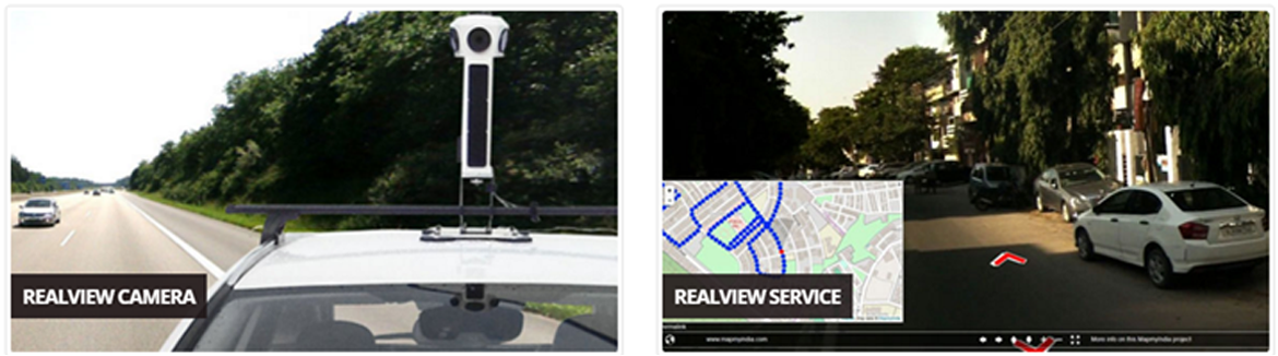
RealView surveys are customized services provided by MapmyIndia to provide three dimensional images or to give 360 ° perspective. The RealView Camera collects and saves highly accurate data which can then be processed using its companion software. The platform syncs the high resolution panoramic camera with a GNSS receiver and a high sensitivity accelerometer to store the real world in a digital format.
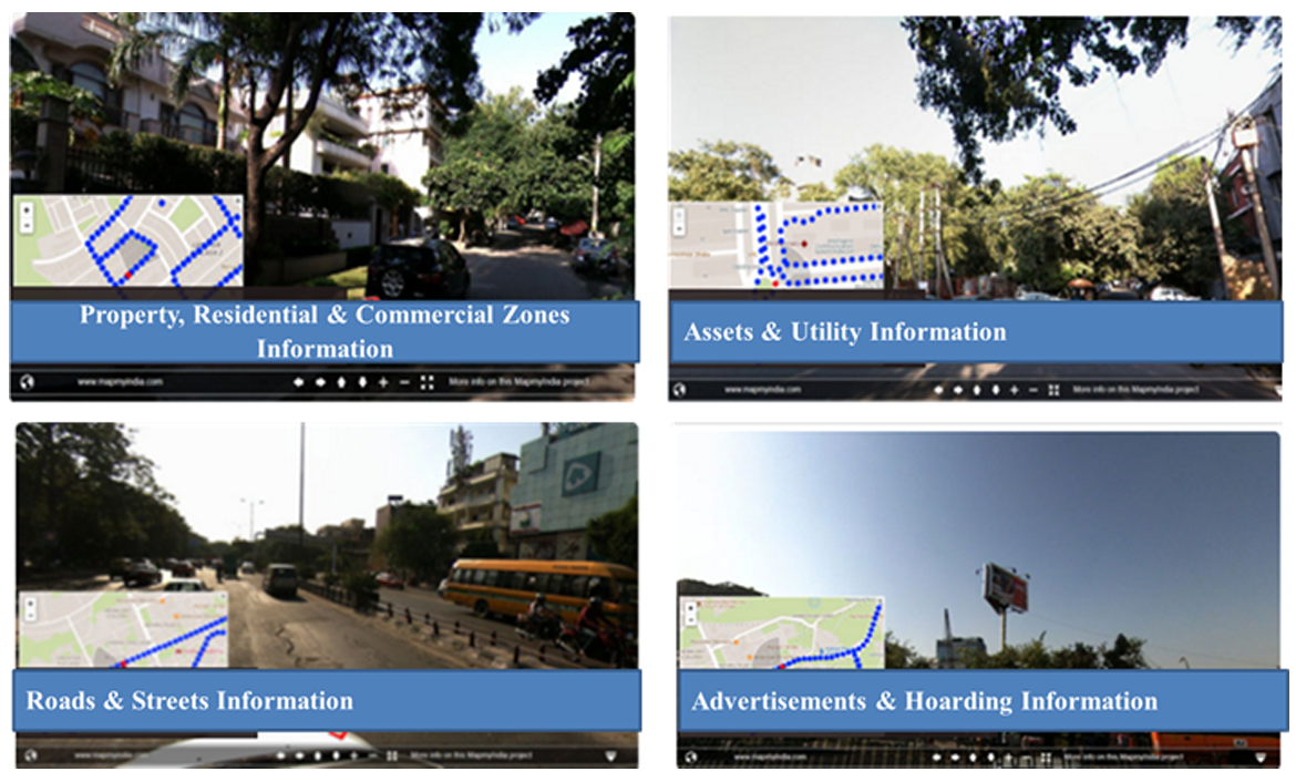
MapmyIndia can conduct RealView surveys for municipal areasto capture GPS referenced panaromas along the defined route showing properties, streets, roads, motorways, railway tracks, plants, residential and commercial zones.
This data can help any government department in Infrastructure Planning & Monitoring, Property Tax Planning & Management, Utility Planning & Monitoring and all kind of Maintenance work. Most importantly, this data would be a vital source of information and reference at time of any Emergency like situation.
Benefits
- With real view, a department can visualize streets, roads, motorways, railway tracks, as well as residential and commercial zones from their office for quick decision making and service deliveries.
- Real View will increase operational efficiency.
- This will elevate the department’s planning, execution and monitoring.
- It provides the government with effective data in times of emergency and disaster.
Sample Screenshots