- Products Products
- Map and Data Map and Data
-
![]() Map Data
Map Data Location data reflecting the real world
![]() Geo-demographic Data
Geo-demographic Data Updated, reliable, industry data
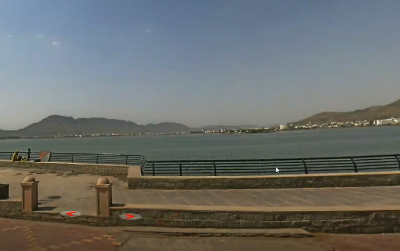
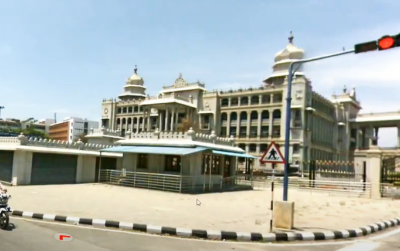
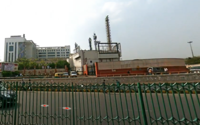
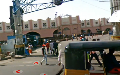
![]() RealView
RealView360° panoramic street images
![]() Map Portal
Map Portal India’s original internet mapping portal
![]() eLoc
eLoc Doorstep digital address system
![]() HD Maps
HD Maps High precision 4D maps
![]() Metaverse 4D Maps
Metaverse 4D Maps Immersive maps reflecting the real-world
-
- APIs and SDKs APIs and SDKs
-
![]() See all APIs
See all APIs 
Explore our entire suite of APIs & SDKs
![]() Maps
Maps SDKs for maps and traffic
![]() Search & Geocoding
Search & Geocoding APIs for search and discovery
-
![]() Routes & Navigation
Routes & Navigation APIs to solve complex routing problems
-
![]() Navigation SDK
Navigation SDK Connected embedded navigation
![]() Mobility & Tracking
Mobility & Tracking SDK to enable live location in your apps
-
![]() Global APIs
Global APIs Maps, search, routes for 238 nations
![]() Personalisation SDK
Personalisation SDK Hyperlocal, personalised O2O marketing
-
![]() Optimisation APIs & SDKs
Optimisation APIs & SDKs Route planning & optimisation
![]() GIS and Analytics APIs
GIS and Analytics APIs GeoBI meets Location AI
![]() Workmate APIs
Workmate APIs Field force automation APIs
![]() MapmyIndia Move URLs
MapmyIndia Move URLs Embed maps, navigation in your apps
![]() NaviMaps SDK APIs
NaviMaps SDK APIs Hybrid navgation for embedded systems
- See all APIs
![arrow]()
-
- GIS, Analytics and AI
- IoT and Automation
- Navigation and Mobility Navigation and Mobility
![]() NCASE Automotive Suite
NCASE Automotive Suite Intelligent mobility platform for PV, CV, EV
![]() Navimaps
Navimaps Offline navigation maps and app
![]() Mappls App
Mappls App Super app for maps, safety, and more
![]() Mappls Gadgets
Mappls Gadgets GPS enabled IoT gadgets
-
![]() Navigation SDK
Navigation SDK Connected embedded navigation
![]() Traffic AI (coming soon)
Traffic AI (coming soon) Convert movement data to traffic analytics
- Drone Services
- Map and Data
- Solutions
- Consumer
- Developers
- Investors

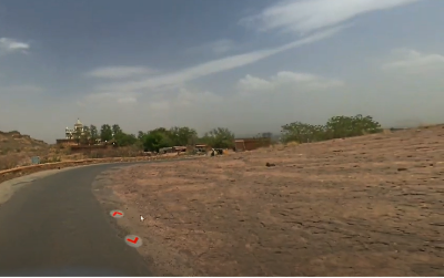
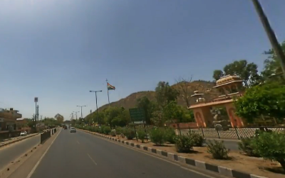
What is RealView?
RealView is a way for you to view the world, right from the comfort of where you are. Now, get a full panoramic view of your assets and even geo-tag, measure and analyse them with photo-realistic quality.
Visualise streets, roads, motorways, railway tracks, as well as residential and commercial zones from the comfort of your own desk. The RealView camera collects and saves highly accurate data which can then be processed using our companion software. The platform syncs the high resolution panoramic camera with a GNSS receiver and a high sensitivity accelerometer to store the real world in a digital format.
How does RealView help you?
Power your business with RealView to increase operational efficiency. Avoid in-person surveys, countless man-hours on the field, and wasted time. Sit from the comfort of your desk and see all your assets, across locations, in one go. Monitor and geo-tag your assets and control your own data collection with the RealView camera hardware. Stay connected to your business on the ground at all times.
Also, elevate your decision making processes. Use RealView to geo-tag and measure any assets of interest to you. See exact location coordinates, determine lengths and calculate areas with ground-breaking accuracy, for anything in your RealView!
How can you use RealView?
Power your business with photo-realistic clarity. Our cameras capture high precision data
that can be processed for various real world applications for any industry vertical.

Infrastructure Planning and Monitoring
Mobile mapping is becoming more and more important for street planning.
Can be used for mobile documentation of streets, roads, motorways, interstates, highways, railways, train tracks and waterways.

Utilities
Captured data can be processed to capture over-the-surface assets.
Data helps to develop corridor maps for electrical, gas and water supply lines.
Choosing optimal corridors (i.e. for streets, pipelines, etc.).

Road Maintenance
With high resolution photographs the quality of the roads can be assessed to plan maintenance schedules.
High sensitivity GPS with 3D accelerometer data can be processed to identify presence of potholes on the roads.

Telecom
Data for height, length and width can be captured on GIS data for telecom industries to plan line-of-sight.

Smart City Planning
Captured data can be built into a model for smart city planning in applications for disaster management, city surveillance, mobility Planning.

Marketing Analysis
Campaign planning, execution and analysis.
Competition analysis.
Market analysis.


There's so much that Mappls MapmyIndia can do for your enterprise or individual requirements. Explore our website to learn more or request a callback/email if you'd like us to connect with you.