- Products Products
- Map and Data Map and Data
-
![]() Map Data
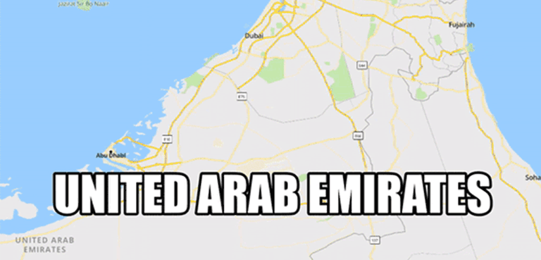
Map Data Location data reflecting the real world
![]() Geo-demographic Data
Geo-demographic Data Updated, reliable, industry data
![]() RealView
RealView360° panoramic street images
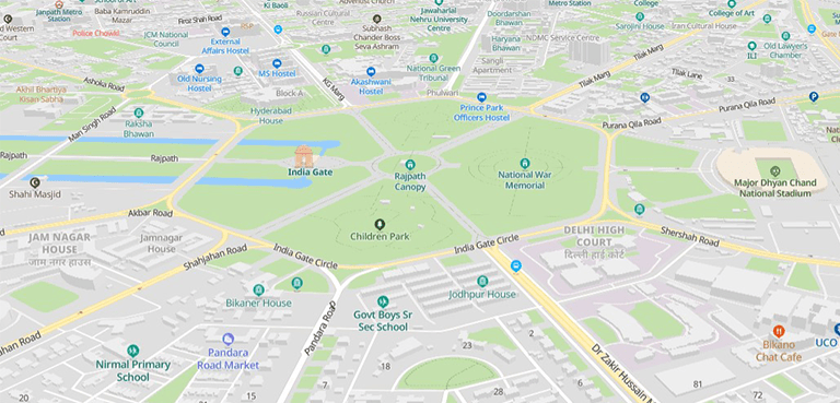
![]() Map Portal
Map Portal India’s original internet mapping portal
![]() eLoc
eLoc Doorstep digital address system
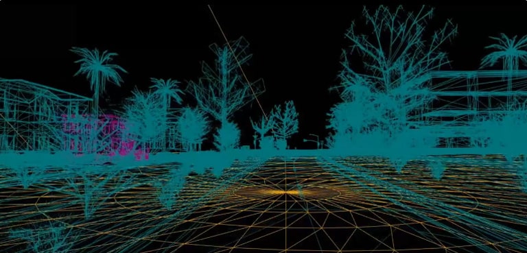
![]() HD Maps
HD Maps High precision 4D maps
![]() Metaverse 4D Maps
Metaverse 4D Maps Immersive maps reflecting the real-world
-
- APIs and SDKs APIs and SDKs
-
![]() See all APIs
See all APIs 
Explore our entire suite of APIs & SDKs
![]() Maps
Maps SDKs for maps and traffic
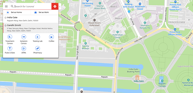
![]() Search & Geocoding
Search & Geocoding APIs for search and discovery
-
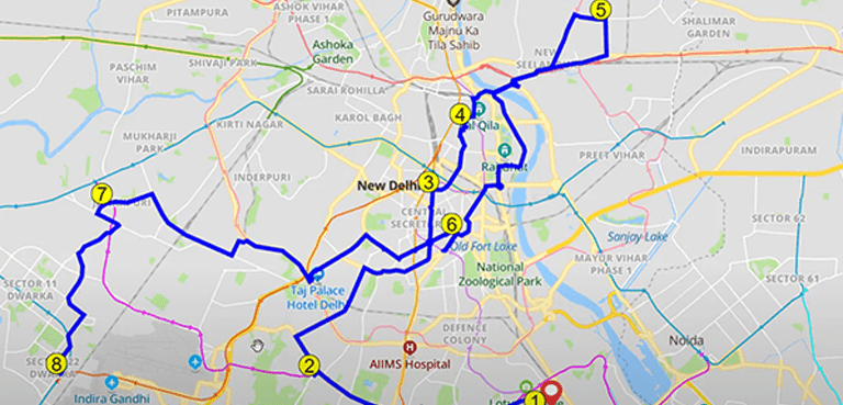
![]() Routes & Navigation
Routes & Navigation APIs to solve complex routing problems
-
![]() Navigation SDK
Navigation SDK Connected embedded navigation
![]() Mobility & Tracking
Mobility & Tracking SDK to enable live location in your apps
-
![]() Global APIs
Global APIs Maps, search, routes for 238 nations
![]() Personalisation SDK
Personalisation SDK Hyperlocal, personalised O2O marketing
-
![]() Optimisation APIs & SDKs
Optimisation APIs & SDKs Route planning & optimisation
![]() GIS and Analytics APIs
GIS and Analytics APIs GeoBI meets Location AI
![]() Workmate APIs
Workmate APIs Field force automation APIs
![]() MapmyIndia Move URLs
MapmyIndia Move URLs Embed maps, navigation in your apps
![]() NaviMaps SDK APIs
NaviMaps SDK APIs Hybrid navgation for embedded systems
- See all APIs
![arrow]()
-
- GIS, Analytics and AI
- IoT and Automation
- Navigation and Mobility Navigation and Mobility
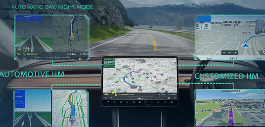
![]() NCASE Automotive Suite
NCASE Automotive Suite Intelligent mobility platform for PV, CV, EV
![]() Navimaps
Navimaps Offline navigation maps and app
![]() Mappls App
Mappls App Super app for maps, safety, and more
![]() Mappls Gadgets
Mappls Gadgets GPS enabled IoT gadgets
-
![]() Navigation SDK
Navigation SDK Connected embedded navigation
![]() Traffic AI (coming soon)
Traffic AI (coming soon) Convert movement data to traffic analytics
- Drone Services
- Map and Data
- Solutions
- Consumer
- Developers
- Investors
-
![]() Maps + technologies for a better
Maps + technologies for a better
future, for India, and for the world
-
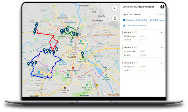
MapmyIndia launches end-to-end planning and optimisation APIs & SDKs to turbocharge last-mile operations.
![Free Maps SDK from MapmyIndia]()
The names you trust, trust MapmyIndia.
Serving industry leaders across big tech, corporates,
automotive and government authorities.
Products
Browse through India’s most comprehensive
suite of mapping, location and IoT solutions.
Map and Data
-
![Map and Data]()
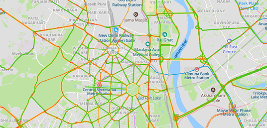
Map Data
Location data reflecting the real world. Learn more
India’s best 4D Time and Space Maps with the largest, most updated and comprehensive coverage.
-
![mGIS]()
![mGIS]()
Geo-demographic Data
Updated, reliable, industry data. Learn more
Powering your geobusiness analytics with continuously updated, reliable and industry-specific data.
-
![Real View]()
RealView
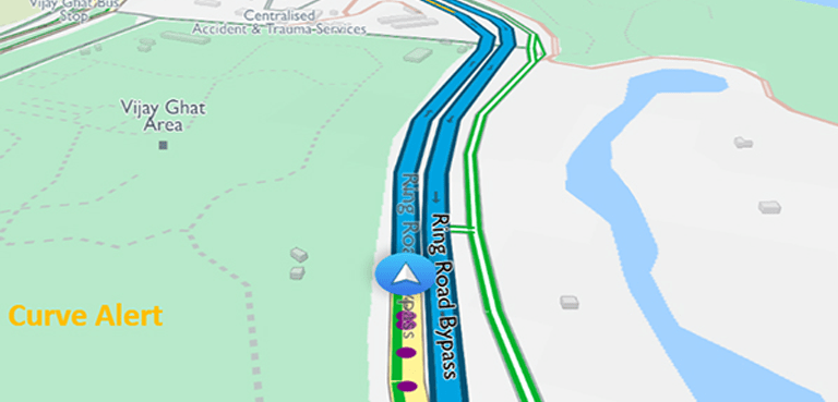
India’s very own 360° panoramic street images service. Learn more
Get a full 360° panoramic view of your assets and also geo-tag, measure, analyse them with photo-realistic quality.
-
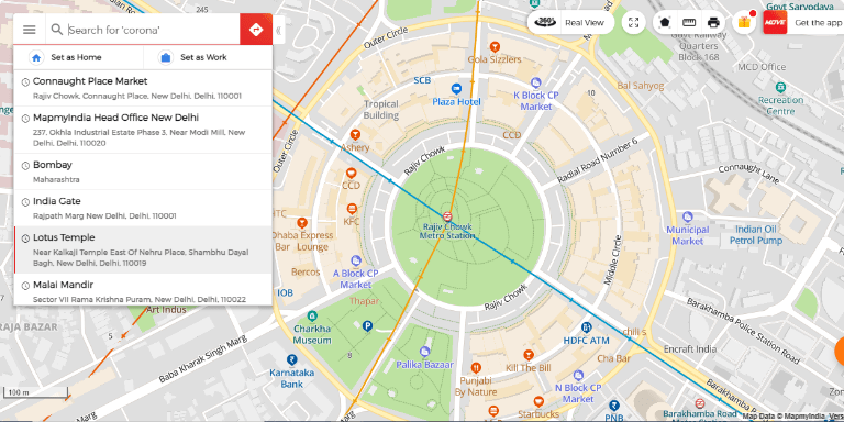
![Map Portal]()
Map Portal
India's original internet mapping portal. Hyperlocal. Precise. Updated.
-
![eLoc]()
eLoc
A doorstep digital address system in just 6 characters. Learn more
A 6-character digital address code to help you or your products & services reach doorsteps.
-
![HD Maps]()
HD Maps
High precision 4D maps built to enable autonomous tech. Learn more
Highly accurate and updated maps built through sensors, IoT devices and the latest technologies that power autonomous cars.
-
![metaverse-4d-maps]()
Metaverse 4D Maps
Immersive, high fidelity 4D maps reflecting the real-world Learn more
Immersive, high fidelity 4D maps reflecting the real-world


APIs and SDKs
-
![Maps]()
Maps
SDKs for maps and traffic. Learn more
SDKs for maps and traffic built on comprehensive map data. MapmyIndia's advanced Map SDKs are easy-to-embed in web and mobile apps across platforms.
-
![Search & Geocoding]()
Search & Geocoding
APIs for search and discovery. Learn more
Embed the most relevant and accurate search experiences with our search, geocode and reverse geocode solutions.
-
![Routes & Navigation]()
Routes & Navigation
APIs to solve complex routing problems. Learn more
Solve simple to complex routing problems for fleets, enterprises and users, with the routes & navigation stack.
-
![Global APIs for 238 nations]()
Global APIs for 238 nations
Maps, search, routes for 238 nations. Learn more
Our directory of APIs & SDKs for maps, routes, search, live tracking, route optimisation, analytics and more.
-
![Mobility & Tracking]()
Mobility & Tracking
SDK to enable live location in your apps. Learn more
Power up your Android or iOS app with live location-tracking capabilities with our IoT & Telematics APIs and SDK.
-
![Search & Geocoding]()
Navigation SDK
Connected embedded navigation. Learn more
Power your apps with our easy-to-embed SDK for online navigation, 3D maps and live traffic.
GIS, Analytics and AI
-
![mGIS]()
![mGIS]()
mGIS
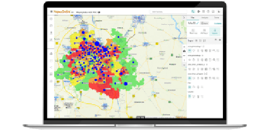
AI-enabled geospatial analytics, GIS. Learn more
The most comprehensive custom mapping enterprise software that brings the power of Geospatial Analytics, GIS and AI to your organisation.
-
![Geospatial & Analytics]()
Geospatial & Analytics
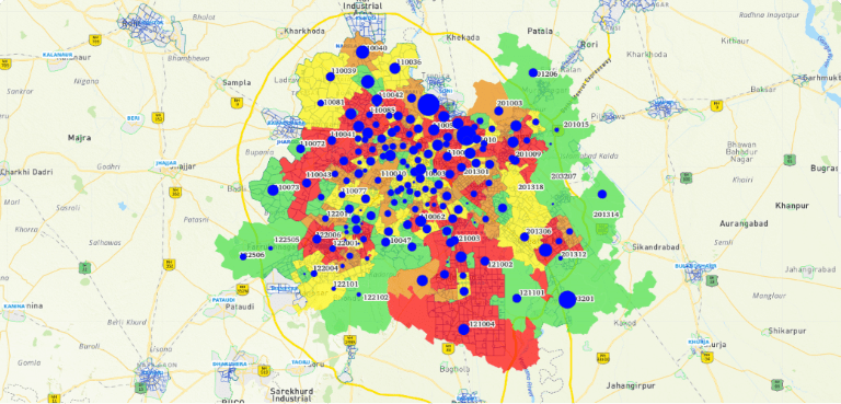
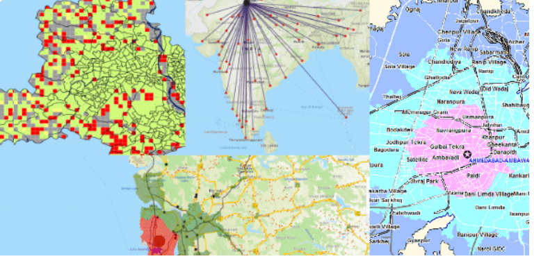
Turn your spatial data into business insights. Learn more
Overlay your business data onto MapmyIndia's vast repository of map data layers to derive spatial insights for taking informed business decisions.
-
![ML/AI engine]()
ML/AI Engine
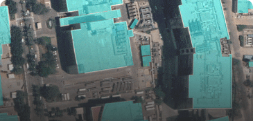
Vision AI to better understand the real world. Learn more
Explore our machine learning solutions on street, satellite and other types of imagery.
-
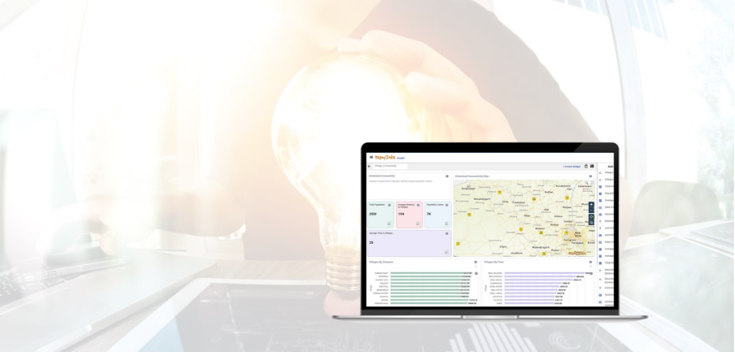
![Insight]()
![InTouch Platform]()
Insight
Configure your own dashboards with maps, graphs, charts. Learn more
An analytics and business intelligence (ABI) platform that supports a full analytic workflow - from data preparation to geovisualisation and insight generation.

IoT and Automation
-
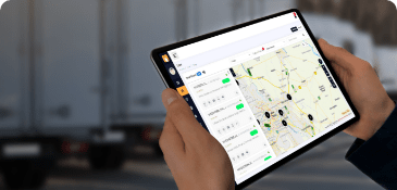
![IoT & Telematics]()
IoT & Telematics Solutions
Turbocharge your fleet with IoT and Telematics. Learn more
Improve fleet productivity, optimise fuel costs and enhance fleet lifespan with MapmyIndia’s suite of end-to-end IoT and Telematics solutions.
-
![Workmate]()
![Workmate]()
Workmate
Workforce management automation. Learn more
The most generalised field force app that uses the power of location intelligence to increase workforce productivity.
-
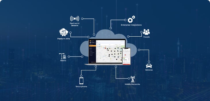
![Intouch platform]()
InTouch Platform
Powerful IoT cloud platform. Learn more
An immensely powerful cloud IoT platform that is agnostic of hardware, cloud, geography, and has deep AI/ML capabilities.
-
![Insight]()
![InTouch Platform]()
Hardware & Sensors
Motion and location-sensing IoT devices. Learn more
Explore from a range of motion and location-sensing devices that cover both, auto-grade and after-market needs.


Navigation and Mobility
-
![Navimaps]()
NCASE Automotive Suite
Intelligent mobility platform for PV, CV and EV. Learn more
Enabling Navigation and Connected, Autonomous, Shared, Electric (n-C.A.S.E) mobility across passenger, commercial and electric vehicles.
-
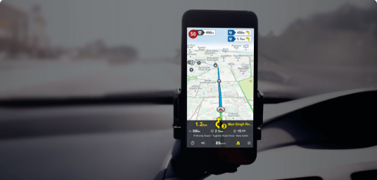
![Navimaps]()
NaviMaps
Offline navigation maps and app. Learn more
Navigate through India with enhanced offline and online 3D maps and live traffic.
-
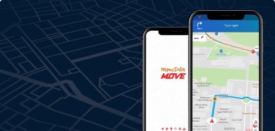
![move_thum]()
Move App
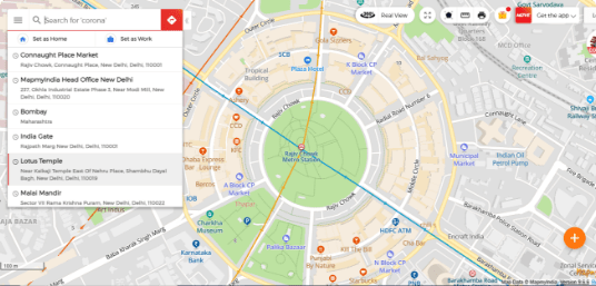
Super app for maps, safety and more. Learn more
India's super app for maps, mobility, safety, hyperlocal social discovery and more.
-
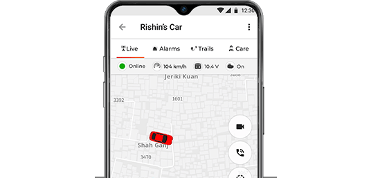
![move]()
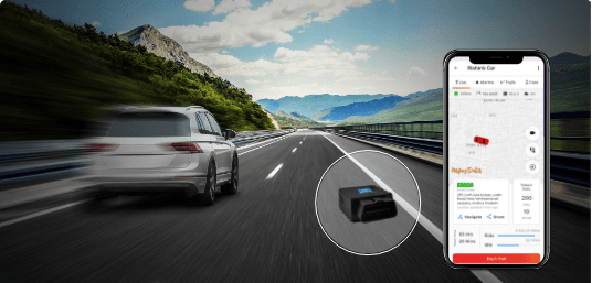
Move Gadgets
GPS enabled IoT gadgets. Learn more
India's best GPS IoT enabled gadgets to track & trace your vehicle anytime, anywhere.
-
![Search & Geocoding]()
Navigation SDK
Connected embedded navigation. Learn more
Power your apps with our easy-to-embed SDK for online navigation, 3D maps and live traffic.
-
![traffic ai]()
Traffic AI
Convert movement data to traffic analytics. Learn more
Convert movement data and traffic information into insights that help businesses and authorities.
Solutions
Bespoke end-to-end technology solutions to solve critical industry challenges.
-
![]()
Enterprise
Digitally transforming your enterprise through maps, location technologies, IoT and geo-analytics.
-
![]()
Automotive
Creating future-ready vehicles with enhanced CX using India's best maps, automotive technologies.
-
![]()
Government
Improved governance, citizen engagement and infrastructure at central, state and city levels.
For Consumers
Enjoy doorstep navigation, real-time hyperlocal updates and vehicle GPS tracking.
Move app
India's super app for maps, mobility, safety, hyperlocal social discovery and more.
Move Gadgets
India's best GPS IoT enabled gadgets to track & trace your vehicle anytime, anywhere.
NaviMaps
Navigate through India with enhanced offline and online 3D maps and live traffic.
Solutions
Bespoke end-to-end technology solutions
to solve critical industry challenges.

Enterprise
Digitally transforming your enterprise through maps, location technologies, IoT and geo-analytics.

Automotive
Creating future-ready vehicles with enhanced CX using India's best maps, automotive technologies.

Government
Improved governance, citizen engagement and infrastructure at central, state and city levels.
For Consumers
Enjoy safer navigation, real-time hyperlocal
updates and vehicle safety tracking.


eLoc : Finding Decoded
Join the future of location sharing. Create six-character
codes from over 2 billion combinations.


For Developers
Create limitless experiences on India’s most
accurate mapping & location stack.
- Maps API
![Still Map]() Still Map Image APIStill Map Image APIMaps API
Still Map Image APIStill Map Image APIMaps API - Maps API
![Traveled Route]() Travelled Route Image APITravelled Route Image APIMaps API
Travelled Route Image APITravelled Route Image APIMaps API - Routes API
![Distance Matrix API]() Distance Matrix APIDistance Matrix APIRoutes API
Distance Matrix APIDistance Matrix APIRoutes API - Routes API
![Heavy Vehicle Routing API]() Heavy Vehicle Routing APIHeavy Vehicle Routing APIRoutes API
Heavy Vehicle Routing APIHeavy Vehicle Routing APIRoutes API - Routes API
![Passenger Vehicle Routing API]() Passenger Vehicle Routing APIPassenger Vehicle Routing APIRoutes API
Passenger Vehicle Routing APIPassenger Vehicle Routing APIRoutes API - Routes API
![POI Along the Route]() POI Along the RoutePOI Along the RouteRoutes API
POI Along the RoutePOI Along the RouteRoutes API - Routes API
![Pedestrian Routing API]() Pedestrian Routing APIPedestrian Routing APIRoutes API
Pedestrian Routing APIPedestrian Routing APIRoutes API - Routes API
![Snap to Road API]() Snap to Road APISnap to Road APIRoutes API
Snap to Road APISnap to Road APIRoutes API - Routes API
![Two Wheeler Routing API]() Two Wheeler Routing APITwo Wheeler Routing APIRoutes API
Two Wheeler Routing APITwo Wheeler Routing APIRoutes API - SDKs
![Geo Analytics APIs]() Geo Analytics APIsGeo Analytics APIsSDKs
Geo Analytics APIsGeo Analytics APIsSDKs - SDKs
![Geo Analytics Listing API]() Geo Analytics Listing APIGeo Analytics Listing APISDKs
Geo Analytics Listing APIGeo Analytics Listing APISDKs - SDKs
![Interactive Maps JS Web SDK]() Interactive Maps JS Web SDKInteractive Maps JS Web SDKSDKs
Interactive Maps JS Web SDKInteractive Maps JS Web SDKSDKs - SDKs
![Mobility & Tracking Android SDK]() Mobility & Tracking Android SDKMobility & Tracking Android SDKSDKs
Mobility & Tracking Android SDKMobility & Tracking Android SDKSDKs - SDKs
![Raster Map Android SDK]() Raster Map Android SDKRaster Map Android SDKSDKs
Raster Map Android SDKRaster Map Android SDKSDKs - SDKs
![Raster Map iOS SDK]() Raster Map iOS SDKRaster Map iOS SDKSDKs
Raster Map iOS SDKRaster Map iOS SDKSDKs - SDKs
![Vector Map Android SDK]() Vector Map Android SDKVector Map Android SDKSDKs
Vector Map Android SDKVector Map Android SDKSDKs - SDKs
![Vector Map iOS SDK]() Vector Map iOS SDKVector Map iOS SDKSDKs
Vector Map iOS SDKVector Map iOS SDKSDKs - Search API
![Autosuggest API]() Autosuggest APIAutosuggest APISearch API
Autosuggest APIAutosuggest APISearch API - Search API
![Address Standardisation API]() Address Standardisation APIAddress Standardisation APISearch API
Address Standardisation APIAddress Standardisation APISearch API - Search API
![Elevation API]() Elevation APIElevation APISearch API
Elevation APIElevation APISearch API - Search API
![eLoc API]() eLoc APIeLoc APISearch API
eLoc APIeLoc APISearch API - Search API
![Geocoding API]() Geocoding APIGeocoding API Search API
Geocoding APIGeocoding API Search API - Search API
![Nearby API]() Nearby APINearby APISearch API
Nearby APINearby APISearch API - Search API
![Reverse Geocoding API]() Reverse Geocoding APIReverse Geocoding APISearch API
Reverse Geocoding APIReverse Geocoding APISearch API - Search API
![Text Search API]() Text Search APIText Search APISearch API
Text Search APIText Search APISearch API
Integrate our catalogue of developer APIs & SDK to do more with location.
We've built a comprehensive stack of mapping and location APIs & SDKs to help developers integrate features, functionalities and capabilities of all our map, geospatial and IoT products & platforms.
 MapmyIndia
 Over 5000 enterprises and leading brands trust MapmyIndia
-
![]()
![]()
Fantastic example of home grown cutting edge technology. @MapmyIndia has built detailed map products for all of India-GIS maps, 3D maps, real view, indoor etc. MMI provides comprehensive tech stack and has rich national & international map data. Built in India for India & the world.
Shri Amitabh Kant CEO, NITI Aayog
-
![]()
![]()
The technology partnership with MapmyIndia is integral to our goal of 'delivering happiness' to our consumers. Integrating their APIs with McDelivery is helping us deliver a great consumer experience while keeping our operations cost-effective and efficient.
Praphull Paliwal CIO - McDonald's India
-
![]()
![]()
Mercedes-Benz India users will immensely benefit from MapmyIndia’s COVID-19 India Guide, as they will now have real-time and accurate information about high risk or no go areas and thus avoid these while travelling. This is a proud moment where the team has developed this much needed innovation to add another layer of safety for our end-customers in India.
Manu SaaleManaging Director & CEO, MBRDI
-
![]()
![]()
With the car rental space becoming increasingly competitive, it is critical for companies to be wary of any inconsistencies creeping into their operations. At Avis, we were determined to offer a seamless experience to every stakeholder in the ecosystem - the driver, the rider and the client. MapmyIndia's custom solutions helped us achieve this objective. With the help of their cloud based maps & mobility platform, not only were we able to automate key transactions in the user journey, but were also successful in dramatically reducing our lengthening credit cycle.
Aman Naagar COO - Avis India
-
![]()
![]()
Being an internet restaurant company, technology is the core of our business. And the synergy with MapmyIndia has been remarkably helpful in achieving some of its crucial aspects. Their APIs help us ensure a great customer experience.
Soumyadeep BarmanCTO - Rebel Foods
-
![]()
![]()
At Yulu, we're leveraging technology to make urban mobility seamless, shareable and sustainable through a user-friendly mobile app. This makes the search & distance capabilities a key feature of the Yulu app. We evaluated MapmyIndia and realized the potential of the platform, we can now offer our users key features at the best price point. Today, MapmyIndia is powering key location functionalities of the user app & the Yulu team is excited about exploring additional capabilities of their map SDKs & location APIs.
Naveen DachuriCo-founder and CTO - Yulu


There's so much that Mappls MapmyIndia can do for your enterprise or individual requirements. Explore our website to learn more or request a callback/email if you'd like us to connect with you.
