Customer Support: +91-9999-333-223

Local Bodies Should Be Efficient Units Of Self-Governance

  • Property tax is a crucial source of revenue for Urban Local Bodies (ULB) in India. The Government of India, post the 74th amendment in the constitution, is focused on making urban local bodies more efficient units of self-governance. Proper assessment of properties and efficient collection of tax is vital for urban local bodies as property tax is the primary source of income and it strengthens their revenue. MapmyIndia supports this Government of India initiative by providing Property Tax Information System, a web application for departments and citizens that assesses property tax based on laws & bylaws followed by the department. This solution comprises of property survey & mapping and data integration with the web app.
  • MapmyIndia has implemented Property Tax Solutions in several municipalities across India and has introduced innovative practices in property tax assessment and administration.

This solution consists of 2 parts:

  1. Property Mapping
  2. Property Tax Information System

Property Mapping

Powering ULB Digitization of Tax Records to enable a self-sufficient system

The first computerization process of the Urban Land Bodies (ULBs) involved digitization of property tax records. However, their digital database is not updated as frequently as it should be. Moreover, the digital database has not been integrated with GIS Property Layers, which enable enhanced decision making, decisions based on accurate ground realities. However, building and maintaining a comprehensive GIS-based property database requires specialized technical resources.

In order to bridge this gap in their system, ULBs are partnering with service providers to:

  • Develop & Integrate GIS Property Layers
  • Build a comprehensive and accurate property database
  • Publish this data through a web application
  • Train ULB staff to maintain database going forward

Benefits of Property Mapping

Increased Property Tax Revenue

Bring all properties into the tax net

Introduce efficiencies into tax administration

Enables Better Planning

Process Flow

  • GIS based assessment of properties

    High Resolution Satellite Image

  • GCP Collection for Geo-rectification

    GCP Collection (DGPS Survey) for Geo-rectification

  • Digitization & Attribution of Features

    Digitization & Attribution of Features

  • Field Validation

    Ground Truthing/Field Validation

  • GIS Base Map

    Updation for Final GIS Base Map

How we do it?

  • This task involves Verification of Property/ Holding Data & Collection of Relevant Information of each Property through:
  • Contact Survey
  • Generation of Database
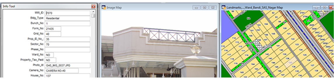
  • Capturing Digital Photograph of each Property or Holding
  • Database & Digital Photograph to be linked with GIS Base Map
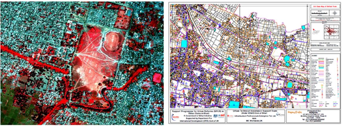
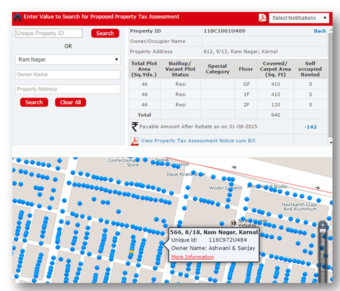
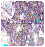
  • The ground survey includes capturing the type of property and making sketches of the structures, where needed, on top of the base map. The ground survey also locates specific household parcels , assigns them unique identification numbers (IDs) and notes these down in the field book.
  • This survey shall ensure that property parcels are properly collected and the data of the respective property is filled in the field book.
  • The field collected data will then be updated on the Digital GIS Base Map as a “Property Layer” with the demarcations of Property, its associated attribute and unique identification number. Existing ULB data is also an attribute in the property mapping, for comparative analysis and further assessment. Lastly, final ground validation of Property Maps will take place and records will be updated.

Creation of Comprehensive Database:

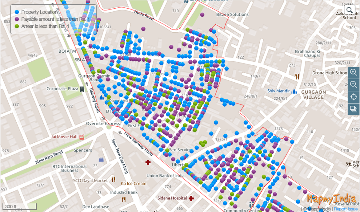
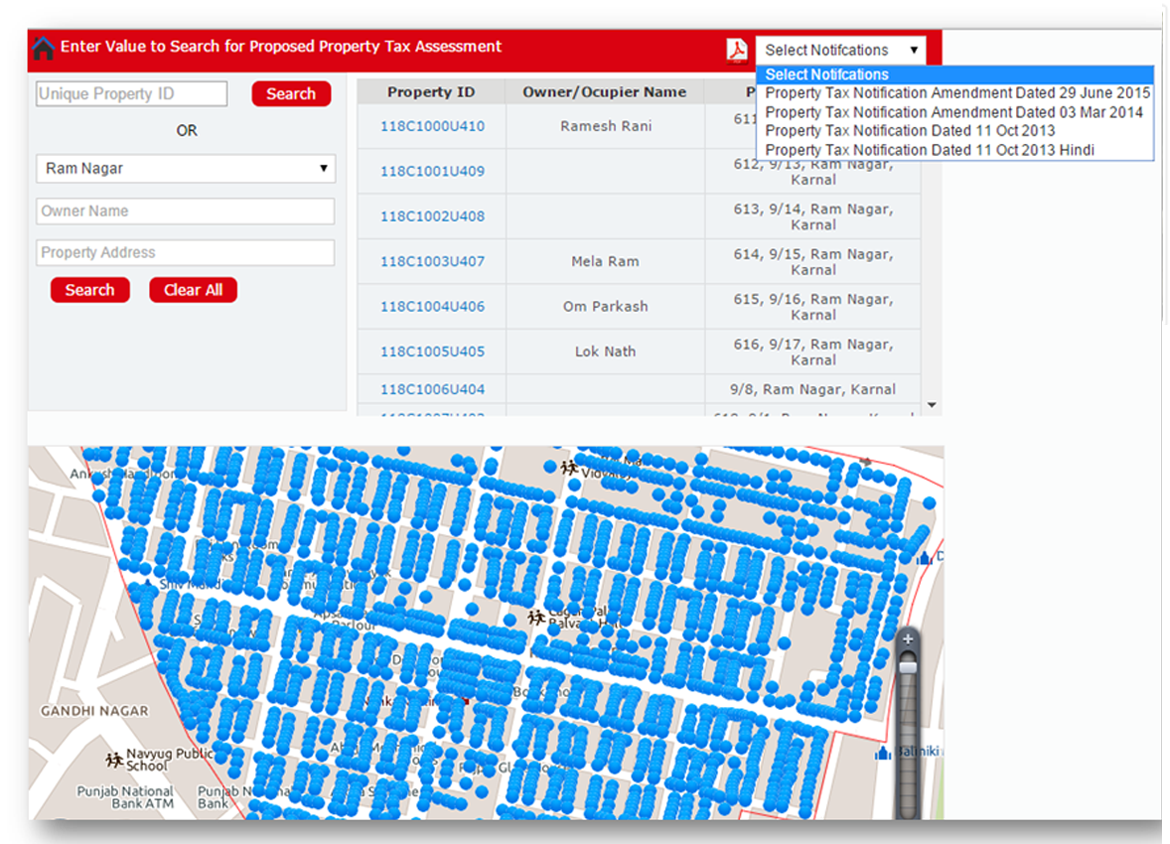
  • Creation of comprehensive UID centred Database linked with GIS Base Map including information of newly collected data, existing data, property tax records, assessment details etc.

Sample Screenshots

Property Tax Information System
properties linking with GIS system

Property Tax Information System

  • Development of comprehensive inventory of properties and linking with GIS system so that the ULB is able to have a full record of properties in the city and bring them under the tax net
  • Making the system capable of self-assessment by providing a formula driven tool to the owner to calculate their dues
  • Improving transparency in the system to realize better collection percentage of the demand
  • Comprehensive database and taxation parameters are important inputs for the “Property Information System”
  • MapmyIndia also renders GIS Professional Services for creation of Comprehensive Database

Stay ahead with MapmyIndia's Smart Governance Solutions

Citizen Friendly

Increased Revenues

Transparency

Enables Better Planning

Features

  • Easy to use: User Friendly, Interactive and Informative Application
  • Access: Role and privileges based access
  • Property Search: The portal will offer functionality to search for property with different level of search capabilities
  • Locating on GIS Map: Interactive map displaying Geographic location of property with all requisite details, Photograph and UID No
  • Query Module that will help to understand various taxation zones, assess tax for a property, cumulative tax of a zone or ULB
  • List of Defaulters
  • Module to show Assessment Details
  • Module for property owners/occupiers to calculate their tax, liability, file self-assessment forms, pay tax and get online receipt
  • Generation of Bill-cum-Demand Notice: Public will be able to access their Bill-cum-Demand Notice online. This facility will be linked to the searching & assessment details facility, where public can View, Download & Print the Bill-cum-Demand Notice in the .PDF Format as per the specification of Municipal Corporation
  • Online Grievance Redressal and Dispute Settlement Module
  • Relational information i.e. existing information with ULB vs. newly collected data
  • Updation module
  • Report & MIS Generation Module

Benefits

  • Increased revenue for the urban local body
  • Buoyancy in revenues to keep pace with inflation and increased costs
  • Simple to understand, transparent citizen-friendly systems and processes
  • System capable of self-assessment and ease of payment by the property owners
  • Lower litigation and associated costs, decrease in revenues locked up for years in litigation
  • Cleaner administration, increasing the faith and trust of citizens in the ULB and councilors
  • Good database and information systems to enable better tax planning and policy making by the ULB

Sample Screenshots