
Land Base Mapping
MapmyIndia GIS datasets & maps are the most commonly used in India, amongst both consumers and enterprises. Built with passion and latest technology, it is best in terms of both quality and coverage; and caters to the need of varied applications across several domains. MapmyIndia enriches its datasets with frequent updates which makes it more reliable, accurate and recent. MapmyIndia has readily available BaseMap for entire country.
Benefits
Lower cost
Save Time
Boost efficiency
Features
- Ground Control points collected using DGPS survey for geo-referencing
- Administrative boundaries like wards and municipal boundaries
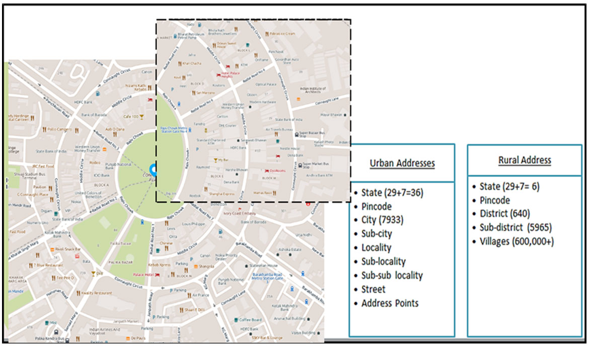
- Detailed address layers including Localities, sub-locality, buildings, building footprints
- Detailed road network with width and right-of-way
- Point of interest data
- Height profiling (by using auto-level survey)
- Land-use and land-cover demarcation
- Specialized layers as per the requirement of the city / ULB
Sample Screenshot


Request Call Back
There's so much that Mappls MapmyIndia can do for your enterprise or individual requirements. Explore our website to learn more or request a callback/email if you'd like us to connect with you.
or