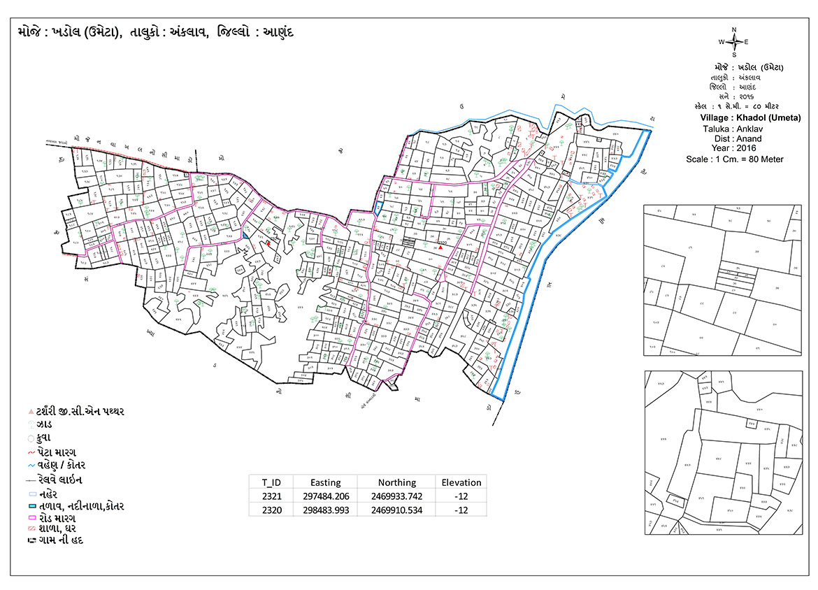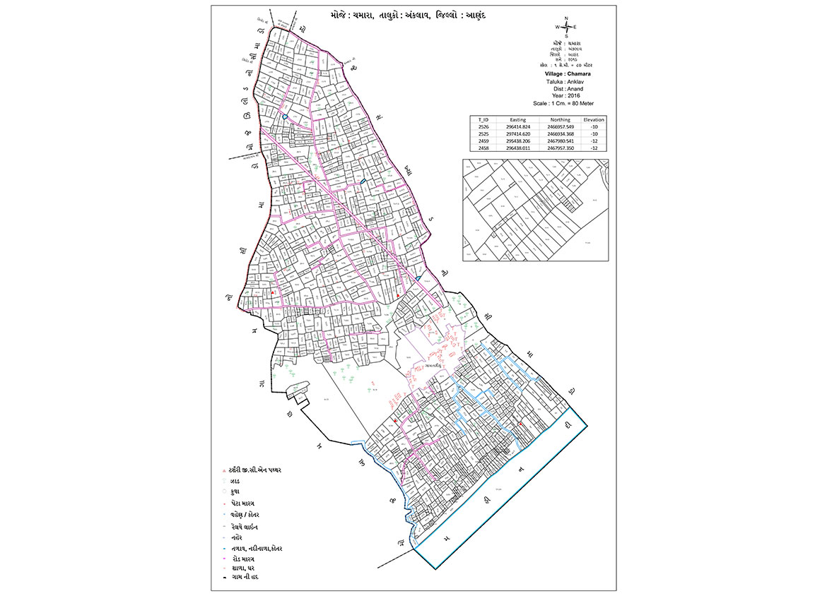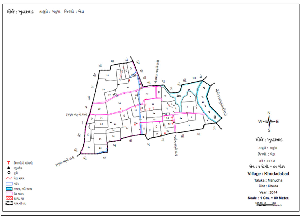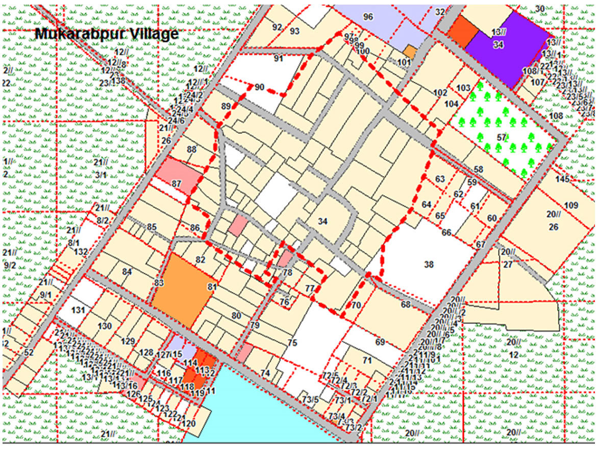
Digitization of Cadastral Maps
The digitization of cadastrel maps will help to create online databases of revenue maps in a digitized form that can be linked to other databases, such as land records, for holistic understanding, planning and analysis.
The process followed is:
- Scanning of village maps
- Indexing and Vectorization
- Linking of Databases
- Making the output GIS-ready
- Training of Staff
- Scanning & Digitization
While conducting digitzation we ensure:
- Accuracy: The vector data and print data are exactly matched (1:1), matched with the original map
- Database standards: the output will be in standards RDBMS format
- Quality, Inspection & Completeness: Printout of digitzed maps are handed over on a regular basis to the district authorities for 100% checking with the original cadastral map. Any deviations are marked and corrected
- RoR verification: Land Revenue Records are sent to RoR (Record of Rights). Vector data is matched with RoR data also.
Survey or Re-survey of an area
- Survey is necessary when there is a new area or an updation of an existing area is required.
The process followed is:
- Ground Control Network Generation
- Pre-Survey Activity
- Survey-Activity
- Post-Survey Activity