Posts Tagged: IoT devices

Journey Risk management: Digital Mapping Perspective

MapmyIndia, with its power of maps & location based IoT solutions, is addressing the needs of organizations in the space of Journey Risk Management. The solution addresses in identifying locations & intensity of static & dynamic hazards, determining impacts & assessing associated risk scores of the routes as well as of the drivers. An increasing number of applications in the transportation industry rely on the availability of accurate high definition digital maps, describing the road network geometry with attributes such as; absolute height, slope, sharp turns, road width, speed limit, number of lanes,
stop sign, zebra crossing, traffic signal, blind turns & pedestrian. The role of spatial correlation further analyzes the spatial viability of emergency services offered for Journey Risk Management. Map identification of the accident-prone zones, hospitals, police stations, fuel stations etc. along the roadways using digital mapping helps with planning, response & recovery efforts, and situational awareness. The high definition map applications and getting information on telematics data from onboard sensors and IoT devices enhance spatial perception. Building rich 3D maps using HD map, Lidars & sensor data attributes, provide recognition and situation awareness to In-vehicle systems & drivers.

To build these High Definition 3D maps with Information about the road infrastructure and potential risks of driving on different routes as well as driver behaviors, MapmyIndia possesses the complete state-of-art technologies that include advanced car survey, Real-View Survey, IoT devices and smart mobile applications. Efforts to enhance road safety are based on the engineering and evaluation of road infrastructure where digital mapping plays a crucial role for safer roads.

Rishin Kalra Senior Vice President, MapmyIndia

Rishin Kalra Senior Vice President, MapmyIndia

Giving a reality check on what the risks are and how using high definition digital map applications address the challenges of the road journey,  MapmyIndia participated on the panel of “Journey Risk Management in Roadsafety” at Federation of Indian Chambers of Commerce & Industry (FICCI) event “Role of Corporates in Road Safety” Rishin Kalra Senior Vice President, MapmyIndia, gave insights on the spatial perspective of the Journey risk management with future of high definition maps and telematics data as a part of its products & solutions would play a big role to mitigate road risks and serve the society at large

Inc42.com features 25 year journey of MapmyIndia, building maps and location data

Inc42.com covered MapmyIndia’s success story of creating India’s most exhaustive, accurate, and information rich digital maps and revolutionizing the use of GIS in the business models in India. The company was started by the husband-wife duo, Rakesh & Rashmi Verma in 1994 who led MapmyIndia’s pioneering and path ­breaking effort to create the foundation, framework and architecture for a robust and scale-able model of digital mapping in India. Today MapmyIndia team successfully delivers India’s most comprehensive and feature rich location data products and services. This unique and highly effective business model of MapmyIndia has been highly acknowledged and recommended in a case study by Harvard Business Review.

“Currently, the company offers an entire API stack, IOT devices, a map app, and is creating disruptive technologies for a better, safer and a smarter India. It has mapped over 10.54 Mn unique Points of Interests, expanded coverage of over 2 Mn Kilometers of road network, 7068 cities at street level with house address level data for 80 cities, 6 Lakh villages, and 3D & 2D landmarks in 86 cities”. The core of the company is that we build maps, says Rohan Verma, CTO MapmyIndia.  Taking forward his parents passion and legacy, his vision is, to, creating the digital twin of the real world. A full 360-degree, indoor, outdoor, where we have an idea of how the world functions. The idea is that one day the digital twin of the world has to be made, for digital world experience.

Not fazed by the competition , Mapmyindia is dedicated to providing value added services with maps and location technologies, an asset for the country, with focus on being better, thus playing a key role in developing smart cities and swacch Bharat initiatives to make a world better place for the billions.

You can check out the featured article at httpss://inc42.com/startups/mapmyindia-maps-gps/?utm_source=twitter&utm_medium=social&utm_campaign=organic and contact us at www.mapmyindia.com for further information.

Tata Tech Talks with Shivalik Prasad, Executive Director of MapmyIndia

“Our world is getting better using cutting edge maps and location technologies”. Maps and location technology have been part of our past, present and future, from ancient history of cartography maps for explorers and adventurers to being used today for automation and Robotics” Shivalik Prasad, Executive Director #mapmyindia gives an interesting talk at Tata Tech Talks

Shivalik Prasad, Executive Director, MapmyIndia

Shivalik Prasad, Executive Director, MapmyIndia

Shivalik talks about how technology is shaping everything focused on building a better future for India, especially through maps and location data innovation. Maps have come a long way and evolved as key component of technology. From ancient historic paper maps to digital maps to navigation maps, maps have became a way of life.

At MapmyIndia, we are trying to bridge the gap between physical and digital world. He gives insights to the new generation of subversive maps that are 3D, real time maps that have emerged. There are live maps with sensors giving real time data of the 360 degree panoramic real view, with live traffic data, probe data and essentially the big data. “We are augmenting this data for connected experience through sensors and host of IoT devices, he says”.
MapmyIndia focuses on the BIG data which is the core component and makes location as an important inclusion in the digital India stack. This includes high definition maps, Laser maps, point cloud, autonomous vehicles, machine learning, predictive analysis, navigation, and innovative technologies created at #mapmyindia to build disruptive solutions. Talking about next generation of solutions are ADAS maps i.e the Advance driving assistance. Taking the lead for ADAS maps, MapmyIndia is building road trajectory that will empower autonomous cars. The gears in engine would change automatically because the cars will have road information of its route. The creation of Indoor maps for malls and museums will help to walk through virtually or physically at 1 cm accuracy with panoramic maps. MapmyIndia is in the process of creating laser maps, already done for 75 cities in India and is continuously building these maps to create point cloud data. These are advanced video maps to be adopted by public and government bodies for planning, service delivery, governance, law enforcement that will improve development, safety and security of the country and the citizens.

India is a growing country and is leapfrogging into a generation of paperless layer. MapmyIndia’s digital eLoc address system is a six digit alpha numeric address system, the aadhaar of the Indian address system that will make location an integrated part of the India digital stack and become a part of the ecosystem that will make our life better. MapmyIndia is creating and stitching all the components of maps and location together and thereby creating the “Real view Digital twin”. India will be highly automated Robotic country, going digital in a big way and maps is a core component of digital economy going forward.

To know more visit www.mapmyindia.com

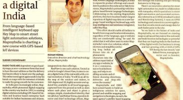
Financial Express – How MapmyIndia is charting a new course with GST-based IoT devices

Financial Express covers how MapmyIndia is charting a new course with GST-based IoT devices. Mr. Sudhir Chowdhary writes Radio taxis are dependent on good quality maps, so are e-commerce firms that need to have the exact address so that the delivery boy knows where to hand over the package. The maps and navigation systems provider has also announced partnerships with government and private agencies, such as Indian Space Research Organisation (ISRO), Idea Cellular, Reverie Language Technologies. Also, Financial Express publishes that the maps and navigation systems provider has also announced partnerships with government and private agencies, such as Indian Space Research Organisation (ISRO), Idea Cellular, Reverie Language Technologies. Check out the full news here – https://www.financialexpress.com/industry/technology/how-mapmyindia-is-charting-a-new-course-with-gst-based-iot-devices/639311/

Financial Express Coverage

How MapmyIndia is charting a new course with GST-based IoT devices

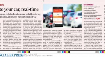
The Financial Express gives a thumbs up to DriveMate!

Vikram Chaudhary from The Financial Express gives a positive nod to DriveMate, our latest IoT connected car technology!

“…DriveMate will warn you if someone is trying to break into your car, it will send you a message if your driver exceeds the speed limit, it would even tell you which all places your car had been driven. DriveMate is more than a car tracker, it also functions as a wallet for storing soft copies of driving licence, insurance, registration and PUC.

Small in size around about two cubic inches, the DriveMate is activated when you plug it into a car’s OBD port (most modern car have this port, generally under the dashboard, near the accelerator and brake pedals). In case you are looking for more features, you can go ahead and buy the DriveMate Max device, for Rs 14,990. Other than that you can get DriveMate Max Program, which includes single-tap connection with your car dealers, service centre or road side assistance.

After first year of usage, you need to pay renewal charge of Rs 2,400/year.

Key Features:

1 year free mobile app access
1 year SIM charges
Unlimited email alerts

You have to buy a separate SMS pakage top-up. Service renewal is required after 1 year (Rs 2,400/year) and the price is Rs 9,990…”