Posts Tagged: enterprise

Flipkart licenses Map Data and acquires a strategic minority stake in MapmyIndia, and the world is abuzz.

"Flipkart Maps a New Route with 34% Pie in MapmyIndia", The Economic Times - December 4, 2015

“Flipkart Maps a New Route with 34% Pie in MapmyIndia”, The Economic Times – December 4, 2015

"Flipkart buys minority stake in MapmyIndia", The Times of India - December 4, 2015

“Flipkart buys minority stake in MapmyIndia”, The Times of India – December 4, 2015

"Flipkart buys stake in MapmyIndia", Hindustan Times - 4 December 2015

“Flipkart buys stake in MapmyIndia”, Hindustan Times – 4 December 2015

"Flipkart picks up stake in MapmyIndia", Mint - December 4, 2015

“Flipkart picks up stake in MapmyIndia”, Mint – December 4, 2015

"Flipkart Takes Stake in MapmyIndia", The Hindu Business Line - December 4, 2015

“Flipkart Takes Stake in MapmyIndia” The Hindu Business Line – December 4, 2015

Smart Cities and Safe Cities: How Maps & Location Technologies can be a critical enabler.

A lot has been written on smart cities by esteemed individuals and various companies. I thought why not put in a few words as to where does MapmyIndia stand in the entire area of Smart City. So what is the definition or meaning of smart city? Different entities and organizations have different meanings, from our definition it means something where various civic and citizen services are digitized and information is available in a heartbeat.

Picture1

As most of you know India is a vast and large country. We have many languages, a very old civilization and a very heterogeneous population with a very complicated addressing system. Each part of India has a different method to make / write addresses. Take the case of Mumbai sometimes also known by its old name of Bombay. In Mumbai there is a famous open area known as Shivaji Park. The road in front of it is officially known as Veer Savarkar Marg, but it is also known as VS Marg, it was also known in British times as Cadell Road and it is also known as Mahim galli (as the road narrows out once it moves from Dadar area to Mahim area). Hence depending on the age of the person, different people call the road by different names but it all refers to the same road. This scenario is common across the cities.

What MapmyIndia has done is to put together a comprehensive Indian address directory structure which can used to plan and build smart solutions i.e. when the new or existing cities are re-planned, the correct address, house numbers, road names, building foot prints, footpaths etc will be readily available for the implementation partners. We believe that using the MapmyIndia database, it will be easier to kick-start smart Urban Planning, which will result in smart cities.

Now for Safe cities, we have launched a product called SafeMate and are working on various emergency response solutions, which I will discuss in a follow on post.

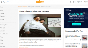
MapmyIndia wants to be present in every car

New Delhi: Rakesh Verma gave up his job at General Motors Corp. in Detroit in 1992 and moved back to India, inspired by a vague desire to do something different.
After getting back home, he and his wife Rashmi made their living with software consulting projects with Tata Steel Ltd (or Tisco as it was known at the time) and IBM Corp.

It was at the 1995 Comdex, the largest software industry trade show in the US, that Verma came across a stall showcasing digital maps. He caught a flight the next day to Albany, the capital of New York state, to strike a deal with Mapinfo, the company that built the software, to create and digitize maps, becoming their India distributor.

Since then, it’s been the story of a dogged entrepreneur stumbling across an idea, creating a niche for himself in the market and pursuing it to its logical conclusion. The Mapinfo deal led to the formation of MapmyIndia, which he set to develop the nascent market for geography-based information systems.

Verma’s first customer was Coca Cola, which had entered India a few years earlier and was looking to expand distribution outside small-towns and into villages.

Click here to see all of Mint’s coverage on the WEF India summit

In order to assign areas for bottlers, Coke needed someone to map out areas in small-towns and villages across the country and MapmyIndia fitted the bill. The company today has 500 enterprise customers including Hindustan Unilever Ltd, Godrej Consumer Products Ltd, Bharat Sanchar Nigam Ltd and Bharti Airtel Ltd, ensuring a steady stream of revenue as it works on improving maps for consumer applications.

In the past two years, digital maps have started gaining acceptability among customers in India and Verma finds himself at the right place at the right time.

As India’s younger generation gets more comfortable using location-based services on cell phones and in cars, MapmyIndia believes this could account for a major chunk of revenue in a few years.

Verma, who comes across as the straightforward, no-nonsense type, has a simple vision.

“Every car and every (mobile) handset in India should have a MapmyIndia map loaded,” he says in an interview in his office in New Delhi’s Okhla Industrial Estate.

At 35 million, the US and Europe account for the bulk of navigation devices sold around the world. Russia, China and India are fast catching up. Last year, four million devices were sold in Russia, and Verma believes that the market in India would grow to about 50,000 this fiscal.

It is this rising acceptability that has resulted in MapmyIndia growing at around 100% each year over the last two years and Verma believes the market is at an inflection point from where usage of its products will rise rapidly. The privately held company does not discuss revenue.

With the entry barriers in the business being high, often a map-making company’s main competition is with itself. A poor experience can turn customers off, making them reluctant to try digital maps again.

That’s why the company has between 300 and 400 surveyors on its rolls at any given time. Extensive checks are done every few months and the changes recorded.

A search for driving directions from Gurgaon, a suburb of Delhi, to the national capital, pulled up a list of roads that should be avoided due to construction work. While changes in road names are recorded, the older, more popular titles are also given.

But it’s still not possible to search for house numbers.

“This would be possible in a few years,” says Verma.

With the time and effort Verma has invested in updating his maps, he is clear about refusing to accept contracts that involve parting with intellectual property (IP).

“If you lose your IP, you lose everything,” he says.

Verma has turned to venture capital funds to raise the money needed to fund the expanding business. Last December, he got $9 million (Rs42.12 crore today) from a consortium led by Qualcomm Inc. While Verma insists that he’s not interested in selling out, he also points out that it’s his responsibility to do take whatever step is right for the business.

Source: Livemint Fri, Nov 6 2009

MapmyIndia in pact with Survey of India

New Delhi: MapmyIndia, India’s leading map and GPS navigation services provider, has announced an alliance with Survey of India. As per the terms, MapmyIndia can use and provide value added services to Survey of India maps. This bolsters MapmyIndia’s already extensive coverage across India, and opens new vistas for business with government and defence organizations.
The Surveyor General of India praised MapmyIndia as “a leading reputed navigational and location based GIS company in India in the digital mapping and cartography space”, and expressed confidence that “this alliance would help fulfil the demand for high quality maps and values to GIS based data sets”.
As the national premier mapping agency for India, Survey of India wishes to actively engage with leading private players in the geo-spatial information market place to utilize their digital topographic/cartographic data sets and bring innovative solutions for the benefit of Indian society. Through this alliance, MapmyIndia can combine its 15+ years of map data collection and processing experience to provide value added services to Survey of India maps. This will allow MapmyIndia to accelerate provision of map based value added services and navigation services across all cities and towns in India and bring benefits of digital mapping to every citizen in India.
On this occasion, Rakesh Verma, MD, MapmyIndia, said: “Our alliance with Survey of India validates the perception of MapmyIndia as one of the premier digital mapping agencies in India. This alliance also allows us to bring our years of experience in building high quality maps for leading private firms to service the government and defence sectors.”

Source: Economic times , 04 Nov 2009