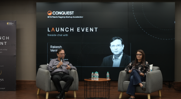
MapmyIndia takes pride in being one of the trend setters in the Geo-spatial Industry in India. Our M.D. Rakesh Verma shared dais with industry’s best of speakers at the special session of the BengaluruIte.biz 2016, to share his experience and insights on journey and path of emerging future of Geo-spatial technologies. The core strength at Mapmyindia is the creation & application of “Location Data” that is evolving at a very fast pace and touching the lives of Individuals, Government & Businesses across world. At MapmyIndia we believe and work towards Make in India initiative. Making India smart through maps & location technologies. Equipped with most advanced, accurate & unparalleled map data for India. Providing an integrated platform of Bhuvan Satellite Imagery & MapmyIndia maps. The emerging future of spatial technology relies on technology, innovation, and opportunities.
Mr Verma highlighted trends in technologies and areas of business that Mapmyindia will focus on. Mapmyindia products and services break traditional GIS barriers by integrating and delivering new and unconventional disruptive technologies that can be consumed and analyzed by the users. The key elements of the MapmyIndia products and services portfolio include the development of big data, Internet of Things, Telematics and Smart City Solutions,. These when combined with the advantages of Geo-spatial technologies like GIS, LBS, Photogrammetry, Satellite and Aerial Imageries, MapmyIndia builds a 3D system with fully a functional set of applications like remote sensing, communications, navigation and positioning, analytics, LBS and telematics services.
MapmyIndia current offerings covers wide spectrum from data development to application development, operating at various levels of the value chain covering the entire length and breadth of the country. The Eco system includes: Creating, maintaining and licensing of core vector maps and licensing of the APIs; real time traffic information and analytics for better planning of the transportation system; real-view for road infrastructure and property taxation; development of end to end customized location based applications for individuals, businesses and government and development of tracking and navigation products.
The Geo-spatial technology is robust and can empower processes and methods thereby leveraging the economic and social development with products and services that bring in trust, transparency, efficiency, productivity and safety, security and convenience.